i‘ve taken hundreds of panoramic photographs (and a few videos) in the last couple of years. what previously cost 20 or 50 k € has become affordable. my 360° photography set cost me not much more than 1500 € — a drone and a 360° camera.
since 2018 major steps forward were taken by the developers of hard- and software for panoramas, two of which i‘d like to mention here:
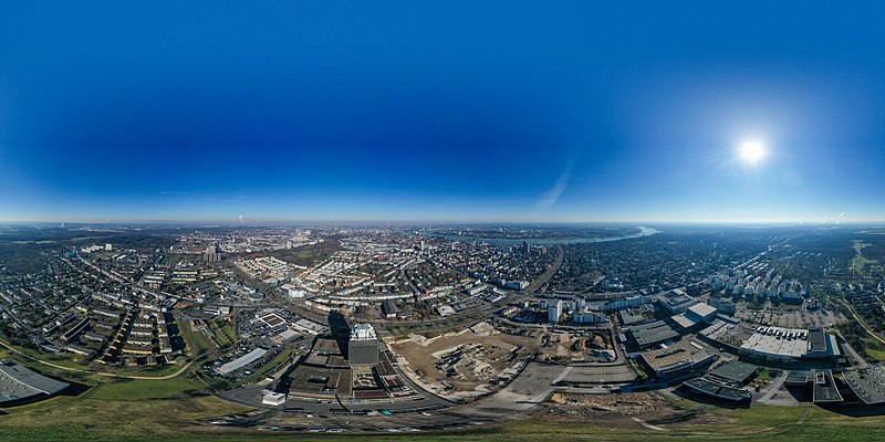
- DJI, the world‘s leader for photo drones, optimized its feature to automatically take 360° photos and stitch them together within seconds. in practice: i fly the drone to a sweet spot in the air, take a brief look around, choose 360°, and off we go. the drone rotates, the gimbal moves up and down, and half a minute later the series of shots are merged into an almost perfect 360° image.
- insta360, a company which manufactures tiny 360° action cameras, has an app for PCs which allows you to create standard movies from panoramic videos. the audience tends to ask: “where did you put all the cameras?“ it‘s only one camera, and all the editing is a free choice of what the surround look offers.
panoramic photos are 3D, they do not end a couple of hundreds of pixels to the right or left. and 360° videos are unsuitable for flat screens. mathematically, putting panoramas onto a flat screen is a projection where you lose information. you either show only a part of the original, or you show it all, with the backdraw of massive distortion. the flattened panorama then looks like a shot with an extreme fisheye lens.
you need helpers to navigate the panorama properly. 3D goggles or VR (virtual reality) devices are the ideal helpers, but they need extra hardware, certain installation procedures, and they keep you isolated: you cannot share your viewing experience with your beloved ones. the alternative is to navigate the image or video with your mouse or by rotating your smartphone. both techniques need software extras. for example you cannot just load a 360° image up to facebook and rely on a proper rotational display; the original needs to fulfill certain criteria as to aspect ratio and meta data. and for mouse navigation you need a browser plug-in on your PC, or a dedicated panoramic viewer app, which is an extra piece of software.
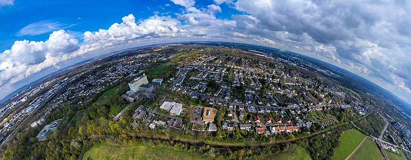
the problem of proper display of panoramic images becomes obvious when you look at them on a web page. if you take a 180° on your smartphone, the stitched image is extremely wide. if you restrict its size to only a part of your page, it looks odd, and the visitor cannot use that thumbnail as a preview, because it does not tell him much. the preview images of a 360° file look depressing — actually so depressing that you don‘t want to care opening the image in a whatever versatile 360° app.
.jpg)
since there is no solution to this, we need to compromise. i personally load up 360° still images to wikimedia commons, because there is a free 360° viewer available. what i also do with my drone panoramas: i select four or five single shots and stitch them together. the result is a not overly distorted file which does not lose much of its value when projecting it on a flat screen. another type of compromise is the image at the very top: it is distorted, but it serves the purpose of showing a certain part of town. that‘s actually an advantage of this method: you can selectively choose the content you want to demonstrate.