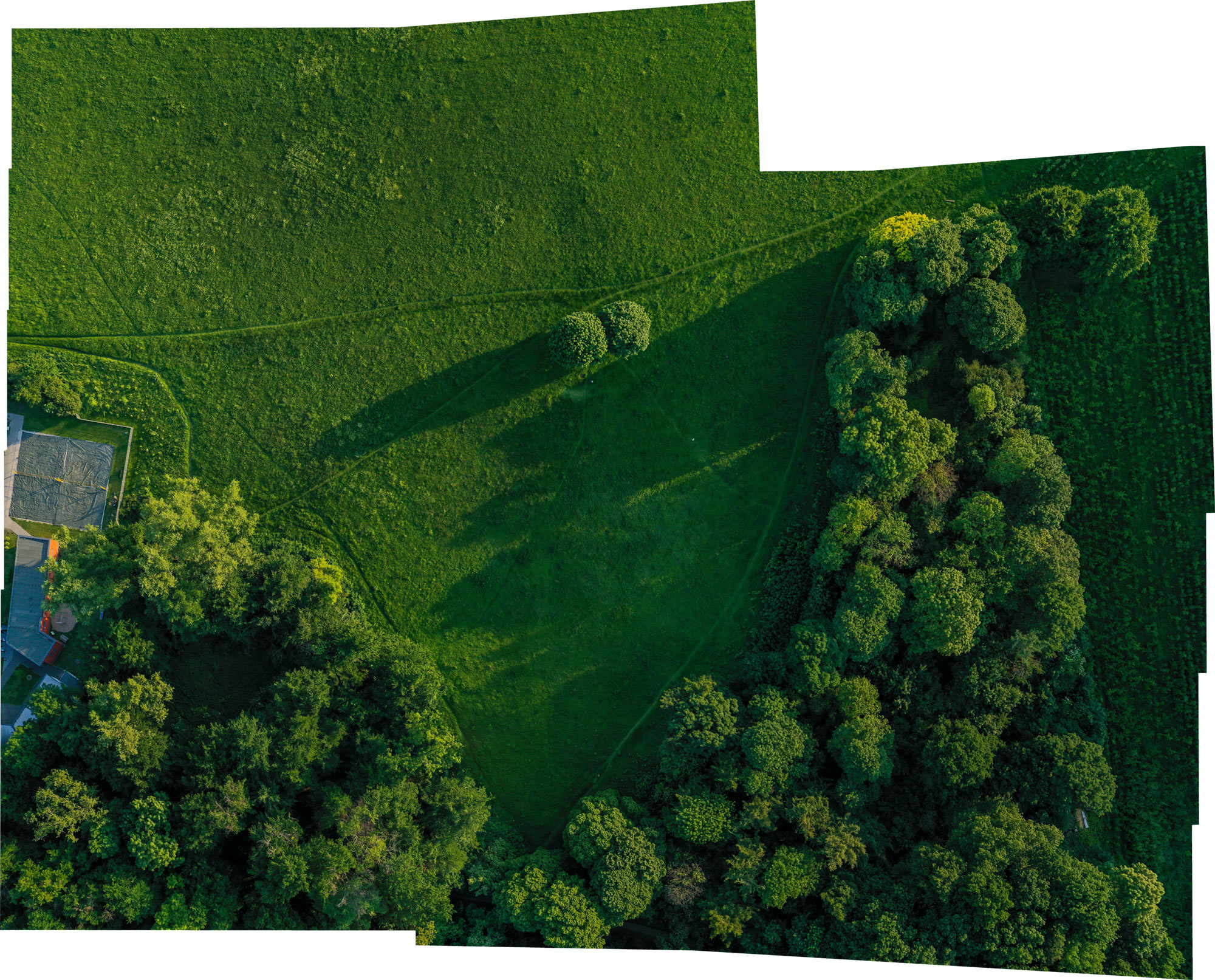
i’m familiar with drone photography, but not with aerial encounters which involve a lot of postprocessing, especially stitching of several images. the photo below was stitched together from 8 single, overlapping orthogonal drone shots and is almost perfect:
the whole open air project took about 15 minutes and produced 58 images. i had set up the flight pattern before actually taking off, using the swiss app drone harmony.

right before take-off the app asked me about the speed of the flight from one stop to the next, and off the mavic 2 pro went. in the brief video you see the blue sky (with the drone, somewhere in the distance) and the drone harmony app at work. it shows how the drone moves from one position to the next, stops, takes a photo and moves on.
the resulting 4k images were excellent. however, no stitching software could handle them. photoshop for example stitched certain parts of the landscape and ignored others.
there were obvious and subtle stitching failures like in the following image where the street was cut in two:
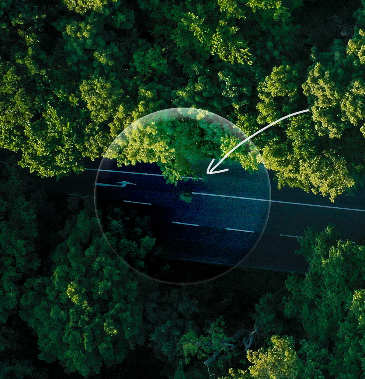
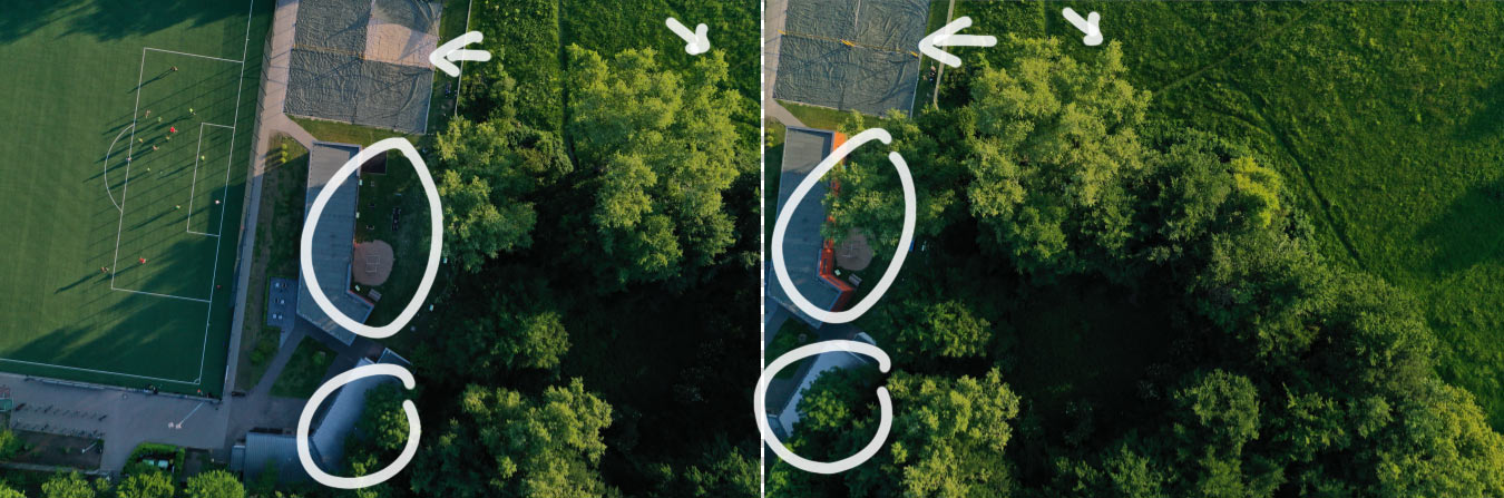
the reason seems to be that objects on the ground look differently from shot to shot. example of two shots next to each other:
the programmers of drone harmony advised me to look for professional drone photo stitching companies. and they explained that the change of perspective from photo to photo actually is a plus, because it provides 3D information. i then created a free short term account with the swiss company pix4D.com, uploaded the complete set of 58 photos and within 20 minutes got the – quite amazing result:
the 3D visualisation came with a rich technical documentation. here’s my brief video showing the result:
pix4D were poor in terms of service. i send an email with a question or two and got no reply.
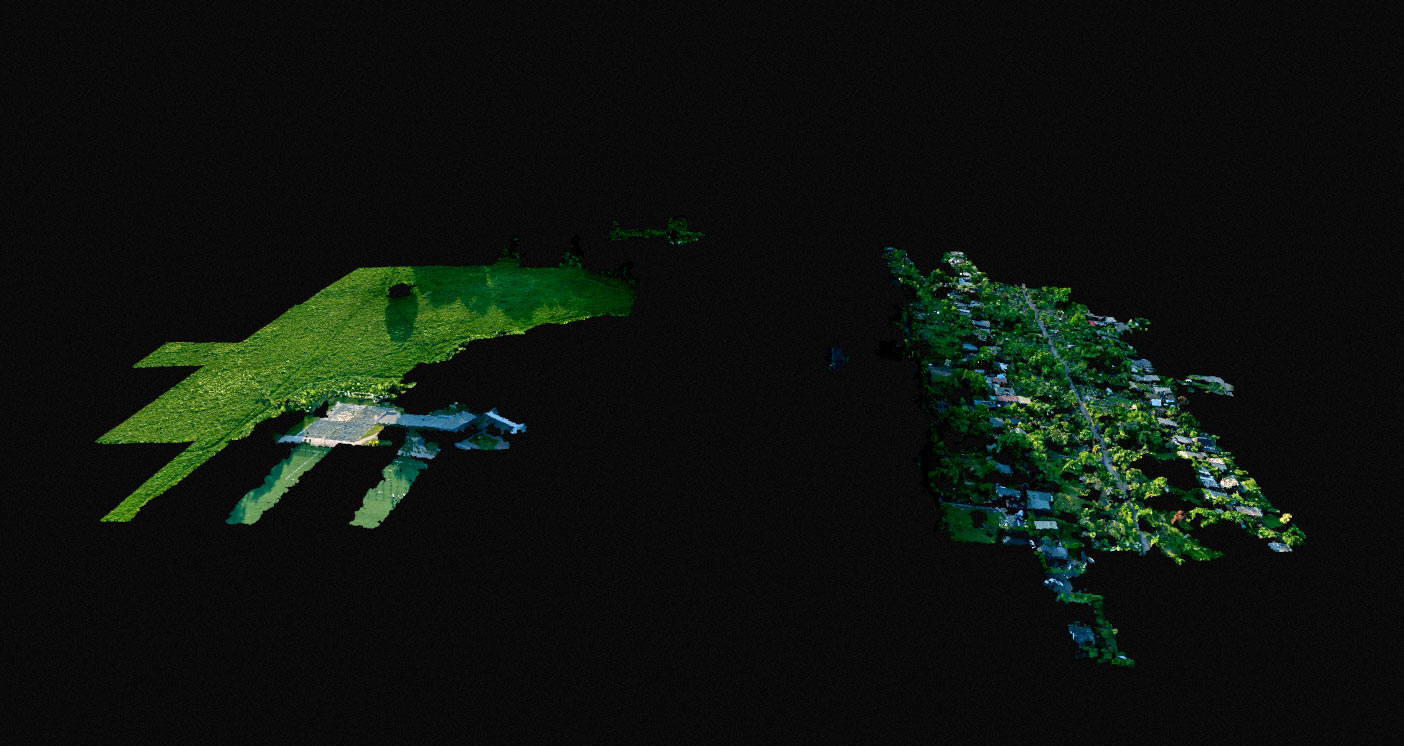
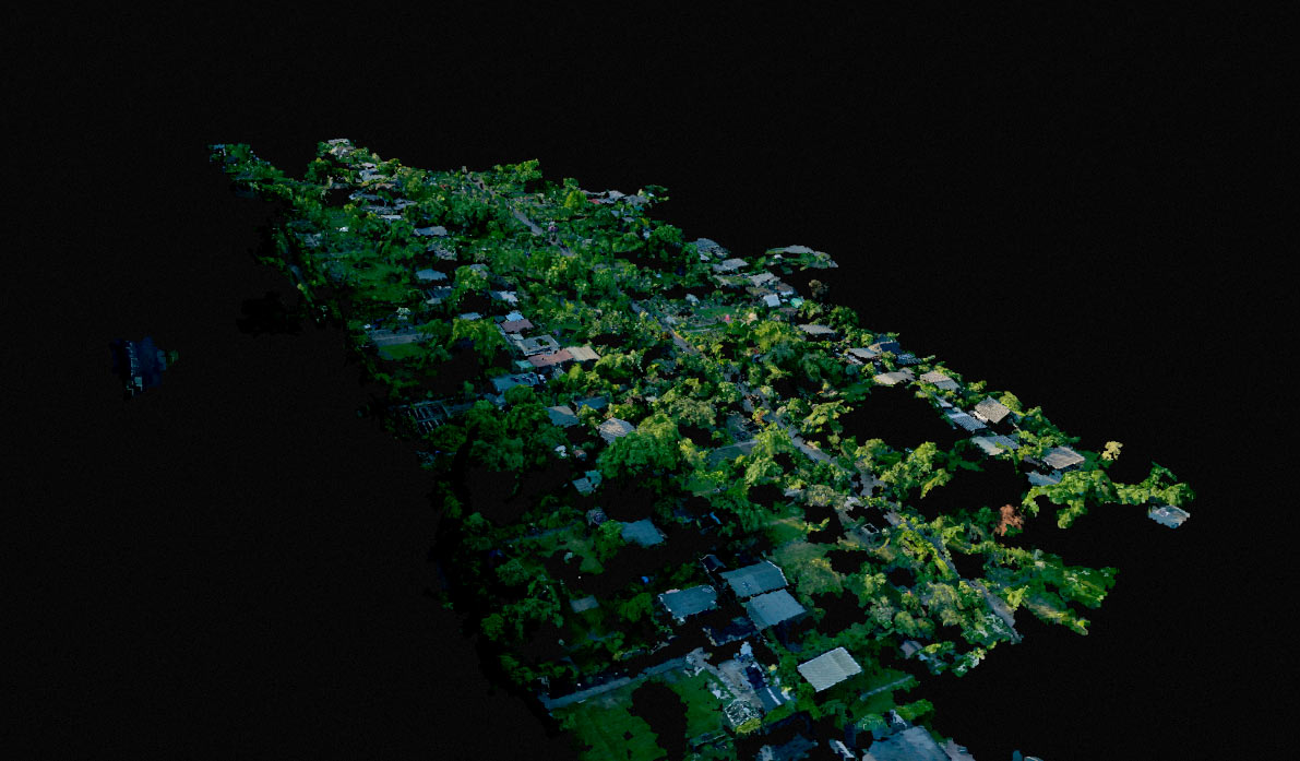
autodesk, a software giant, has a 2D to 3D tool in their portofolio. it’s called Recap, or, if you’re dealing with photographs: Recap Photo. the results below are from recap. they come with a much less information about the scene than pix4D, they’re not getting the full picture of my drone flight either, but they have nice visualisation options. below are two examples of my garden drone project, computed by recap.