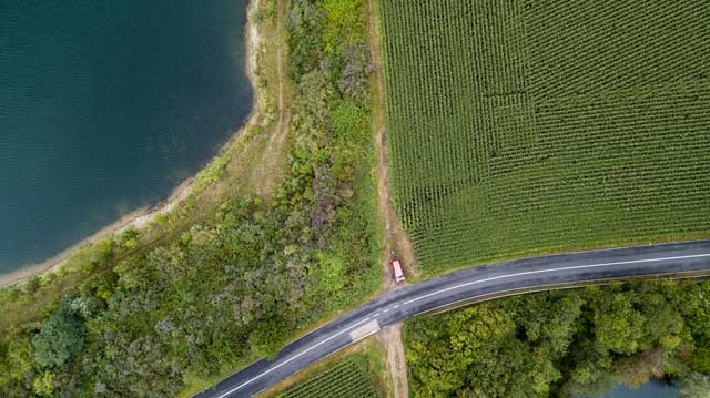
how many meters wide is this scenery? 100? 500?
i’ve struggled with taking vertical panoramas. a vertical panorma means flying the drone at an exact altitude across a certain area, stopping at regular intervals in order to take photos by looking straight down, and finally stitching them all together. with some drone apps such as litchi you can create exact flight patterns using waypoints, and you can tell the drone what to do at certain waypoints, such as taking a vertical photograph before flying to the next programmed spot. i did that the other day and found that the distances i had planned were to long, so that the panorama software ran into stitching problems.
so i looked into distances: what diemension long and wide can the DJI mavic pro lens cover from an altitude of exactly 100 meters? i could have looked up the focal length of the drone’s camera and started the calculation from there, but instead i chose a section of a lake i had photographed recently. i opened google maps in satellite view and checked the dimensions of the water: 50 meters.
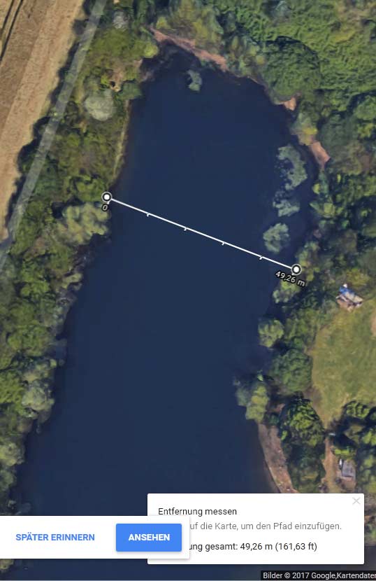
google maps says: this is 50 meters.
i compared the dimensions my mavic shot and came to the conclusion that the lens covers about 160 x 80 meters on the ground if it flies 100 meters high. the phantom pro lens has a slighter wider angle and covers a bit more. in order to stay safe for taking vertical panoramas you should stop at every 100 meters in one axis and at 50 meters in the other dimension.
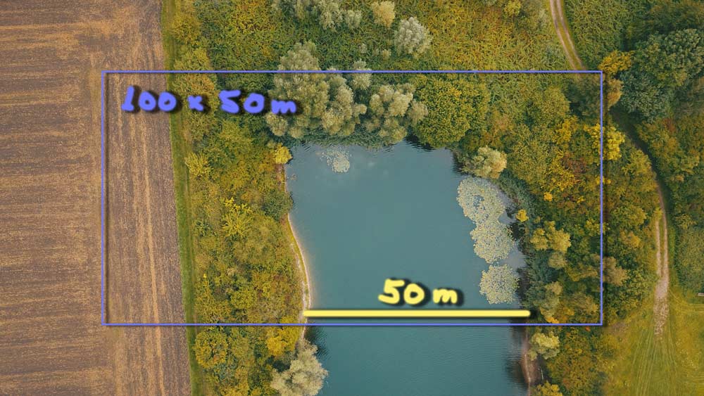
safe dimensions for vertical shots (alt: 100 m)
i give you a few prominent examples: the brooklyn bridge is about 600 m long, from coast to coast. for a panorama you need to take 6 photos to cover the whole bridge.
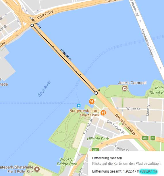
brooklyn bridge is 600 meters long.
can we cover the leaning tower of pisa in one shot? with ease! the → st. peter’s square in rome? no way! we need at least 6 photos to create a satellite-like hi res map of it.
side topic: when i took some photos for stitching (see → here) i thought about the legal situation in different countries. in most western states it’s prohibited to fly over private property such as a garden or a factory. in practical reality nothing new can be spied out with drones flying at 100 or so meters altitude. nothing “new”, because satellelites do that all the time, and services like google maps or google earth provide those insights (oversights) for free, and free of legal punishment. the tricky thing is when amateur drone pilots fly low across private property, invoking irritation, rage and lots of negative feelings against ALL drone pilots.